Russian River
 
Armstrong Redwoods State Park
 
  Explore Armstrong
  Home
  About Coast Redwoods
  Walks & Hikes
  Marguerite Wildenhain
  FAQs
  Map of the Grove
  Location Map
  School Groups
  Rules & Regulations
  Environmental Protection

What's Related
Camping
Park Maps
Fishing
Guerneville
Ten Nature Hikes
Top Spots
Lodging

Other State Parks
Sonoma Coast State Beach
Armstrong Redwood State Reserve
Austin Creek State Recreation Area
Fort Ross State Historic Park
Kruse Rhododendron State Reserve
Salt Point State Park
Lake Sonoma Recreation Area
Regional Parks
Bird Walk Coastal Access
Black Point
Cloverdale River Park
Doran Park
Foothill Regional Park
Forestville River Access
Gualala Point Park
Healdsburg Veterans
Memorial Beach
Occidental Community Center
Pebble Beach
Pinnacle Gulch
Ragle Ranch Park
Shell Beach
Shiloh Park
Steelhead Beach
Stengel Beach
Stillwater Cove Park
Walk On Beach
West County Trail
Westside Park

Walks & Hikes

Armstrong Redwoods State Reserve and Austin Creek State Recreation Area Suggestions for walks and hikes:

1. Round Trip under a mile:
Parking lot to Armstrong Tree and Forest Theater along
2. A Little longer:
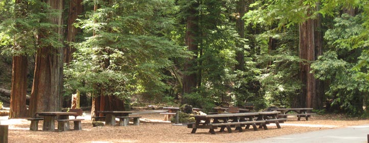
(1.7 Miles) Parking lot to Armstrong Tree and then to Picnic Area along Pioneer Trail. Back along road, Redwoods all the way.
3. A 2.2 mile loop with a 400 foot climb:
Parking lot to Picnic Area by way of the East Ridge along East Ridge Trail. Back along road or Pioneer Trail. A moderate hike along a ridge shaded by Firs, Oaks, and Madrones with a stroll back through Redwoods. Pioneer trail or road and back. A short, easy stroll through the Redwoods.
4 A 2.3 mile loop – A bit more strenuous that #3:
Parking lot to Armstrong Tree and then up Pool Ridge Trail. Loop back to Picnic Area and return along the Pioneer Trail or road. A 500 foot steady climb with lots of switch backs.
5. A 3.3 mile loop – Definitely a hike:
Combine #3 and #4. Parking Lot to Picnic Area by way of East Ridge Trail. Then loop back along Pool Ridge Trail to Armstrong Tree and back to Parking Lot. Up 400 feet, down, up 500 feet and down again.
6. A 5.6 loop with a 1100 foot climb:
East Ridge Trail from Parking Lot to Gilliam Creek Trailhead and loop back along Pool Ridge Trail.
7. A 9.0 mile loop:
As in #6 but continue on East Ridge Trail to Bullfrog Pond and back to Gilliam Creek Trailhead and return along Pool Ridge Trail.
8. A 5.0 mile Back Country loop:
Elevation change of 1000 feet. East Austin Trail from Trailhead (Vista Point) to Gilliam Creek. Loop back along Gilliam Creek Trail and East Ridge Trail to Bullfrog Pond.
9. A 10 mile Back Country loop:
As in #8 but continue on East Austin Trail to Gilliam Creek Service Road and then loop back to Gilliam Creek Trail and back to Bullfrog Pond.

Back Country Campsite Mileages:
Tom King Camp 3.1 miles from Vista Point
Mannings Flat Camp 4.1 miles from Vista Point
Gilliam Creek Camp 3.9 miles from Trailhead

Elevations:
Parking Lot 120’ Picnic Area 172’
Manning Flat 293’ Gilliam Creek Camp 200’
Bullfrog Pond 1250’ Gilliam Creek Trailhead 1200’
East Ridge Trail at Picnic Area Cutoff

Content created by the California Department of Parks and Recreation


Visitor Center Phone Numbers <-- Vacationers use this
Advertise - Business Contact
Popular: Vacation Rentals - Restaurants - Wine - Spas - Weddings
Towns: Healdsburg - Forestville - Monte Rio - Windsor - Bodega Bay - Jenner - Geyserville
Parks: Armstrong Redwoods - Lake Sonoma - Sonoma Coast State Beach - Salt Point
Copyright © 2001 - 2013 Cielo Projects. All rights reserved.
Use of this site signifies your agreement to the Terms of Use.